Rivers never stop; they spark life and shape civilizations. Even the mighty Han River, which flows to the Yellow Sea, begins as a tiny spring on a mountainside. Deep in Taebaek's forests in Gangwon Province, a cold stream wells up from a crevice in rock that holds about 500 million years of Paleozoic history. Quiet and ancient, this place keeps a steady temperature year-round, moistening the land and marking the opening of a long journey.
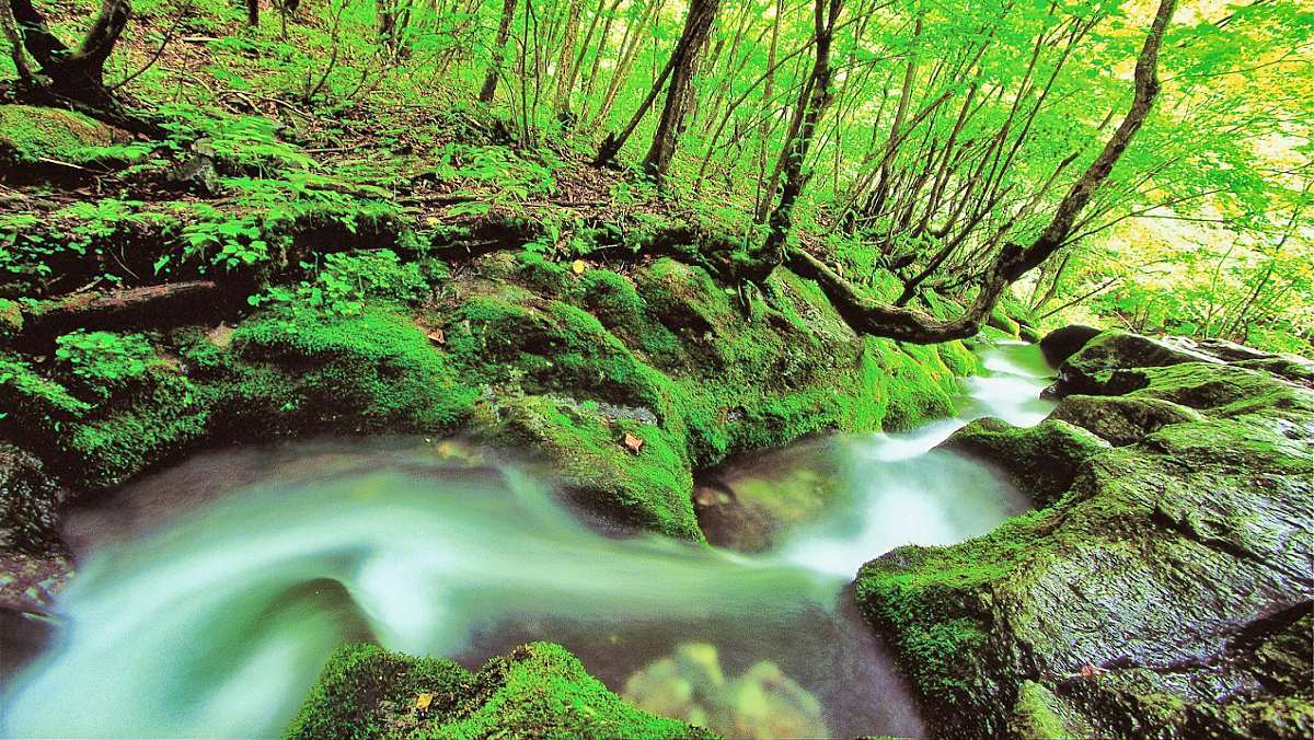
Geomryongso, the Han River’s source, is a spring that bursts through limestone formed in the Ordovician period of the Paleozoic era. Roughly 2,000–3,000 tons of groundwater surge to the surface each day. Over millennia, that flow has sculpted striking landforms out of the limestone. Swirling currents have drilled circular potholes in the rock, leaving marks on the valley floor that resemble a dragon’s wake. The terraced waterfalls, shaped by characteristic limestone erosion, stand as nature’s sculptures carved across eons.
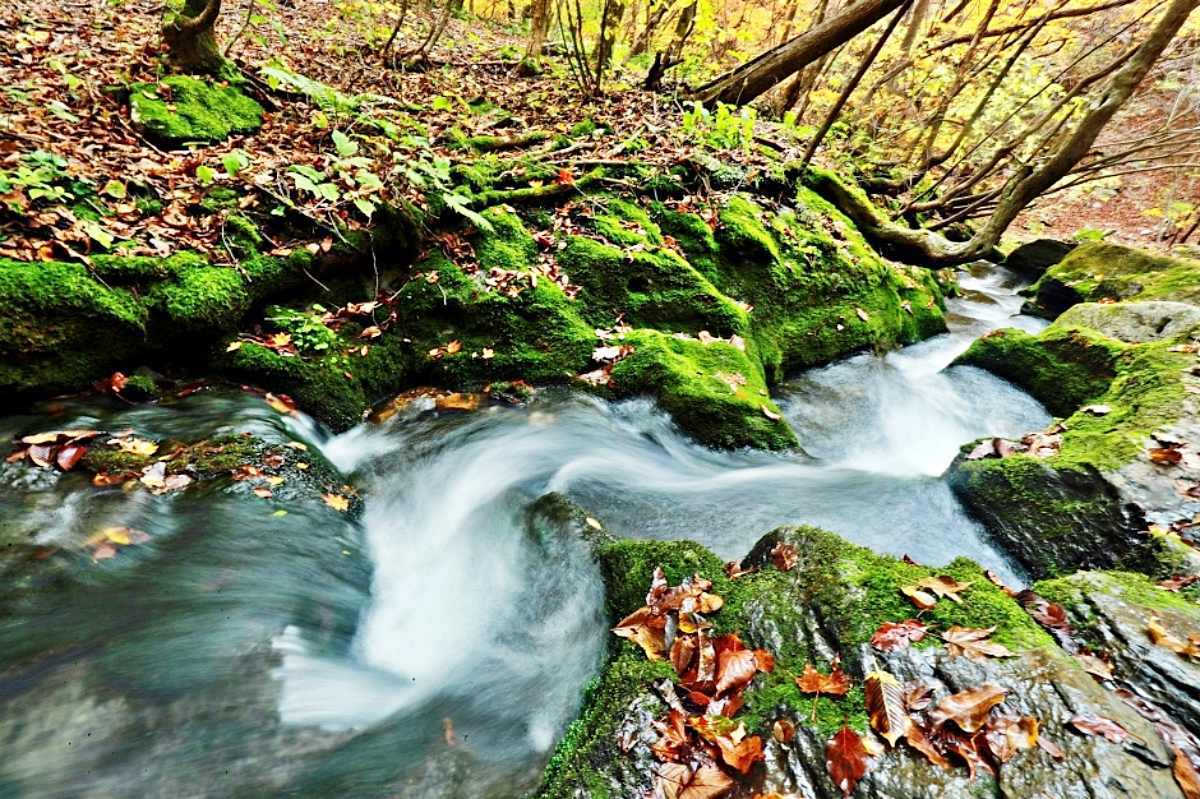
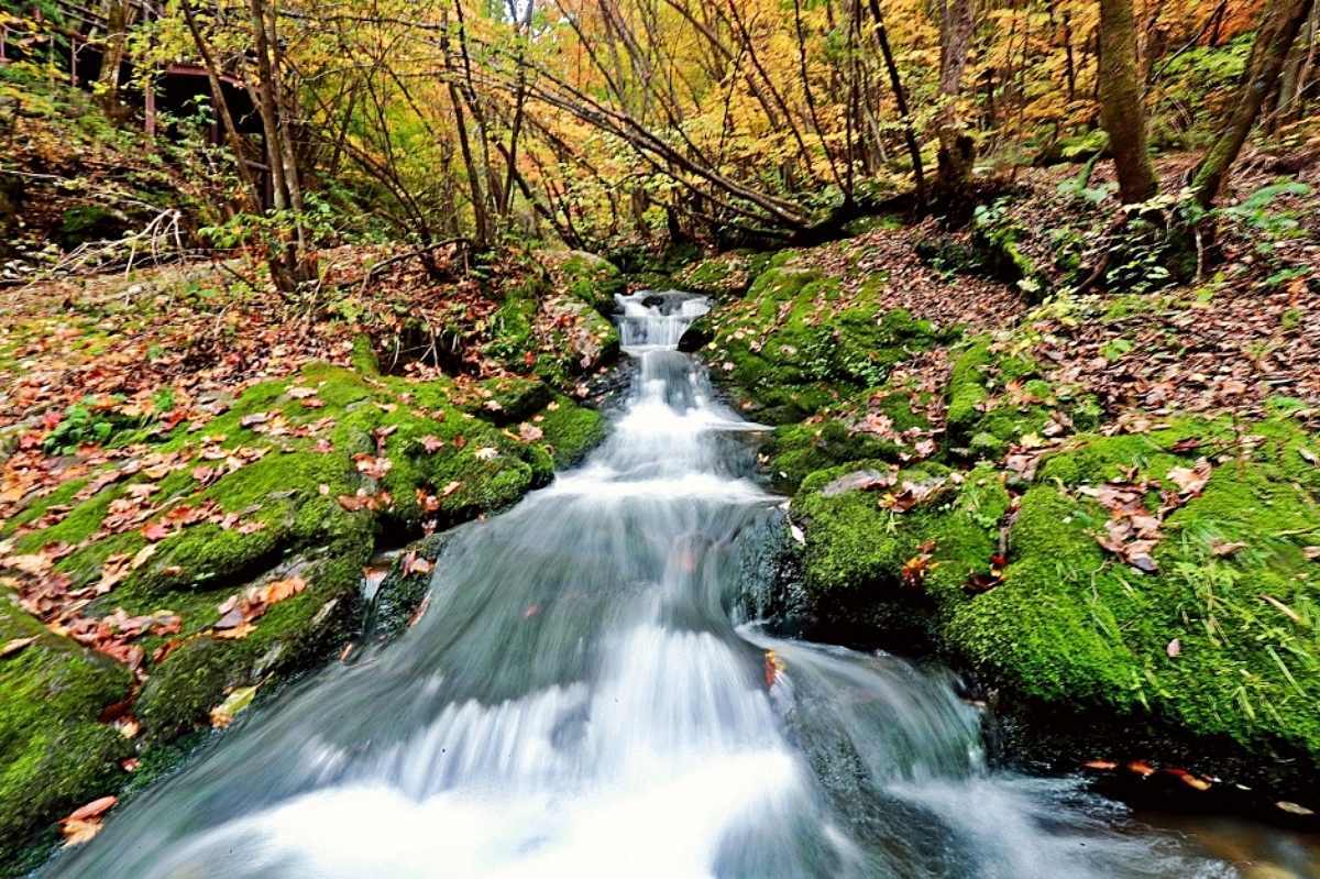
Local legend says an imugi—a proto‑dragon from the Yellow Sea—climbed this river to become a dragon and paused here. Geomryongso, whose name means “sacred dragon’s pool,” was recognized for its unique terrain and scenic value as National Scenic Site No. 73. Today it’s a key attraction in Taebaeksan National Park and the Gangwon Paleozoic National Geopark. The stream that begins here follows Goljicheon through Jeongseon and Yeongwol, growing larger until it becomes the Han River we know.
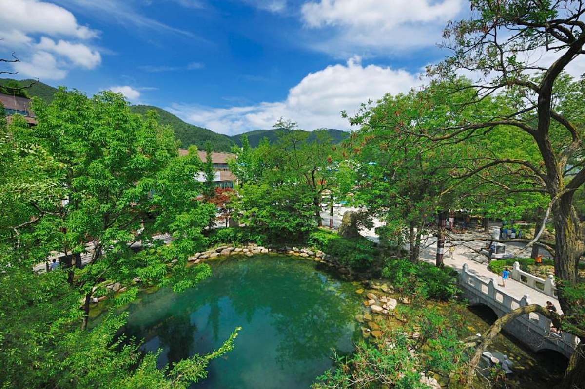
Taebaek is also the source of the Nakdong River, the lifeblood of the Yeongnam region. Hwangji Pond in the center of Taebaek marks the start of the Nakdong’s 1,300‑ri course (about 510 km / 317 miles). Historical records like the Dongguk Yeoji Seungnam and Daedongjiji mention this pond, which divides into upper, middle, and lower sections. Around 5,000 tons of clear water rise here daily, and the pond is listed among Korea’s top 100 famous waters for its quality and historical significance. Now an urban park, it offers residents a place to relax while quietly symbolizing the start of a great river.
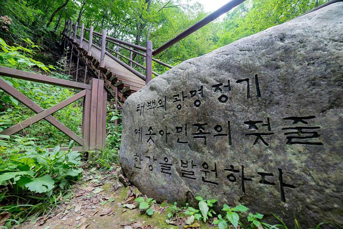
To visit Geomryongso, follow a lush forest trail. From the Geomryongso parking lot, it’s a 20–30 minute walk to the spring. Geomryongso is open year‑round with no admission fee. Taebaek, which holds the headwaters of two of Korea’s major rivers, offers visitors a deep sense of connection and a peaceful escape. A town that cradles the starts of two great rivers is special on its own. Taebaek’s forests, rocks, springs, and ponds quietly reveal where great rivers begin and invite us to reconsider the meanings of the waterways we often take for granted.
Get your daily personal horoscope report! What will today bring?